Mobileye Connect Platform
Watch Your Fleet Grow Safer In Real Time
Finally, Mobileye’s pioneering ADAS technology is available in a fleet management tool. With the Mobileye Connect Platform, you can optimize your investment in safety by tracking your fleet’s performance through the real-time alerts your drivers receive from the Mobileye 8 Connect collision avoidance system. Ride along with your drivers from anywhere in the world thanks to AI-powered fleet data.
Gain Visibility into Your Fleet
optimize your investment in fleet safety

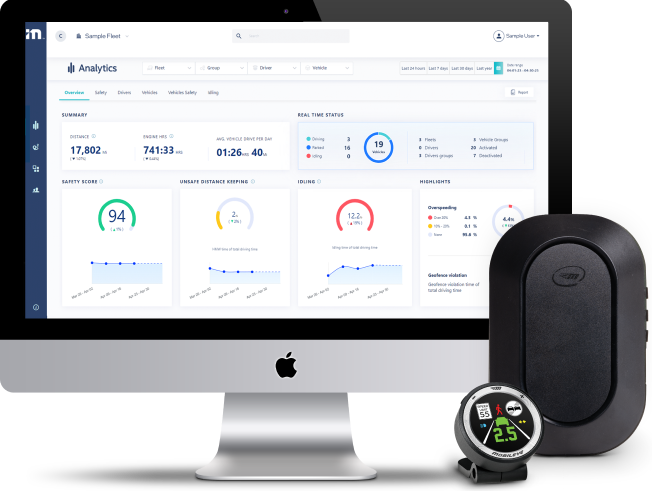
Track Fleet Safety Trends
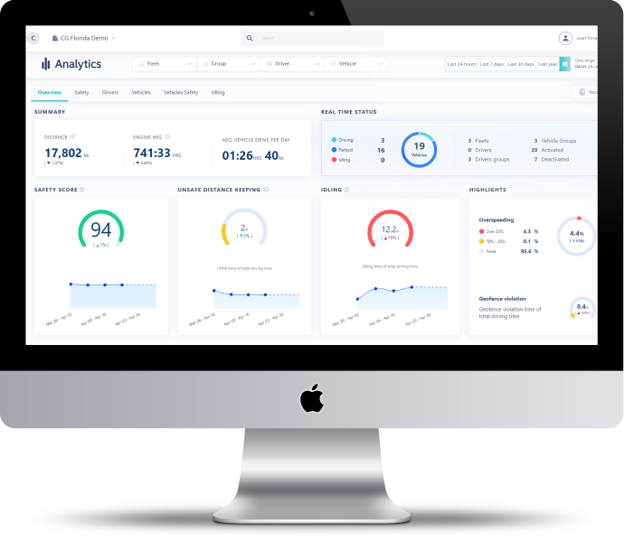
MCP harnesses the data from your Mobileye 8 device, helping you identify risky driving habits and improve future training opportunities.

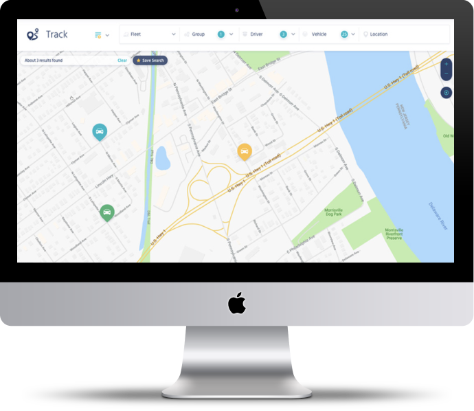
Optimize Operational Efficiency
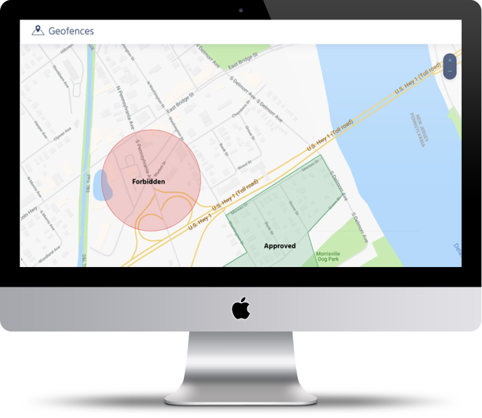
Use Mobileye's GPS capabilities to locate, track, and trace active vehicles, all in one place. With no additional hardware or installation, you can easily establish geographic compliance and monitor asset utilization from anywhere.

Go Beyond Traditional Telematics
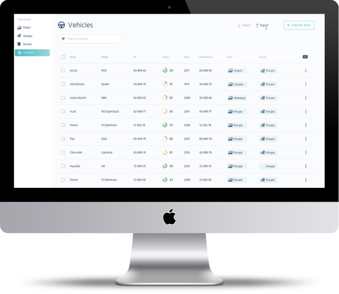
With MCP, you don't just know where your drivers are, you know how they're driving. Precise vision sensor alerts help visualize your fleet safety with easy-to-use, standardized driver scores.
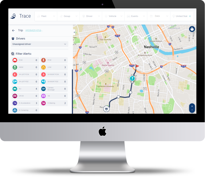
Real-time alerts
Pedestrian & Cyclist Collision Warning
When the driver comes close to colliding with a pedestrian or cyclist ahead
Forward Collision Warning Including Urban Forward Collision Warning
When the driver comes close to colliding with the vehicle ahead
Headway Monitoring & Warning
When the driver follows the vehicle ahead too closely
Lane Departure Warning
When the driver leaves the lane without signaling
Important Performance Metrics
Speed Limit Indicator
When the driver exceeds the posted speed limit
Harsh Acceleration
When the driver accelerates rapidly
Harsh Cornering
When the driver turns a corner at high speed
Harsh Braking
When the driver brakes suddenly
© 2024 Mobileye