Reduce Collisions with Advanced Driver Assistance Systems
Retrofit your vehicles with Mobileye collision avoidance technology
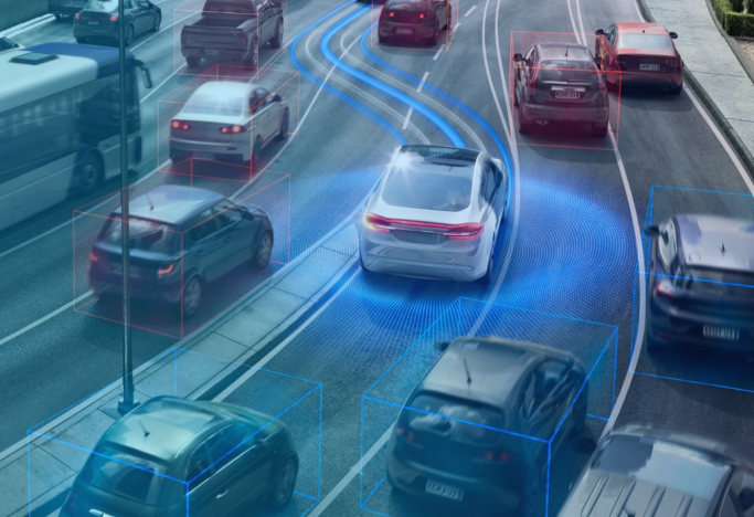
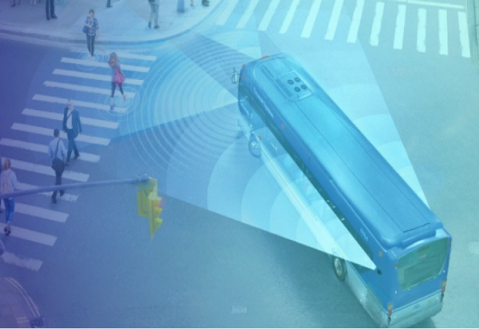
More Than Just a Collision Avoidance System
Technology you can trust
Mobileye technology is integrated into over 300 new car models from leading auto manufacturers. With our retrofit system you too can enjoy the safety benefits of this technology without having to purchase new fleet vehicles.
Easily Adaptable
The system can retrofit to any fleet vehicle regardless of size, make, model, and driving environment.
Improves driving behavior
Driving with the system installed, drivers become more aware of their behavior and naturally begin to adopt safer driving habits.
Affordable & cost-effective
Reducing collisions with Mobileye can save money on repairs and subsequent insurance premiums. Typically, fleet managers see a return on investment within 12 months.
50+
Global automakers rely on Mobileye technology to make their vehicles safer
125M+
Vehicles are equipped with Mobileye technology
What makes us the safest company in Phoenix is our use of technology — including Mobileye. We won't let a car on the street without it.
Brandon Gauer
Owner, VIP Taxi

Case Study
Polk County Sheriff’s Office
For law enforcement, Mobileye developed an enhanced product that adapts when the vehicle has its lights and siren on in pursuit. Read to learn more about how Polk County Sheriff's Office uses Mobileye to prevent collisions. Click here for download case study

Blog
Integrating Technology Into Your Fleet – The Easy Way
Integrating technology into your fleet doesn’t have to be overwhelming. A well-thought-out approach can de-stress the process, and ensure greater adoption rates.

Blog
Traffic Safety in the Dark: 5 Steps Every Driver Can Take
Why do so many pedestrian injuries and fatalities still occur after dark? Read for more information and steps you can take to mitigate the risks of driving at night.
Mobileye’s Insurance Referral Program
Interested in seeing how you can offer Mobileye ADAS to your clients?
Learn More
Mobileye’s Insurance Referral Program
Interested in seeing how you can offer Mobileye ADAS to your clients?
Learn More© 2024 Mobileye